NexusLRS Mobile
Connect your DOT to your road network Anywhere
Bridge the gap between field and office
Getting mile points in the field traditionally is a pain, while DOT’s are required to report on more and more things based on the LRS every year. Viewing your LRS is traditionally difficult via mobile, not anymore. NexusLRS allows you to interact with your agency’s road network the easiest way possible! This includes displaying your real time location on the LRS as it follows you.
Fundamentally, field workers still aren’t often consuming the agency’s LRS that they are increasingly required to report based on. NexusLRS Mobile bridges this gap so everyone can speak the same language.
Real-Time LRS
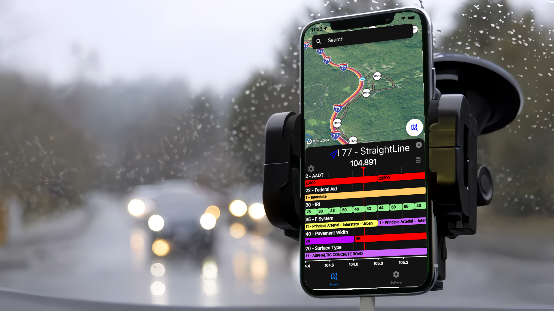
NexusLRS mobile automatically updates your position on the LRS in real time. One point every second, in an accurate and consistent manner. As you move along the LRS, your position on the LRS will update in real time.
This flagship feature allows you to view your location in real time along with the straight-line diagram information displayed at the bottom of the screen.
Completely Offline
NexusLRS is completely offline. When you open the app for the first time, it downloads the entire map dataset and LRS roadway information to your phone and then the computation is done on your phone not some server that requires a network connection.
This applies to both the core location service and the base map itself, as the base map tile data is stored locally on the phone.
No matter what your network connectivity status is, NexusLRS will work exactly the same no matter what.
Interactive Map and LRS
NexusLRS mobile display a vector base map with your organization’s road data as well as interactive linear referencing that has the following features:
Interactive straight line diagramming, pinch to zoom and swipe/drag left or right to change measures to view the road and road events at a specific location
Long press to get mile point measure
Smart road search - allow users to search for a road in a human readable way

“NexusLRS our lifeline. It is a vital tool we use several times a day. Not only is it needed to get accurate milepost numbers for daily timesheets, but it is also used to find road names, route numbers, road composition, RIL information, if the road is state maintained or not and more. It is a very well-designed app and is actually the most useful app we use at the Elkview 0122 Org.
Without it there exists no easy ways for our crew chiefs to find accurate milepost information leading to the the mileposts documented on timesheets will be incorrect, which will make our Core Maintenance Plan incorrect as well. It truly is key to data integrity and reporting at WVDOT.”
— Becky H, Elkview 0122 Org, WVDOT

